
Why does Michigan have an Upper Peninsula? The short answer: Michigan gave up a disputed border strip around Toledo to Ohio, and Congress offered it the western Upper Peninsula in return as part of the price of statehood. Michigan rejected the deal once, accepted it at a second convention in December 1836, and became the 26th state on January 26, 1837. What looked to many people at the time like a poor trade later proved to be one of the most valuable in the state’s history, once copper and iron were found in the north. This article explains how Michigan got the Upper Peninsula, why it went to Michigan rather than Wisconsin, and how the two halves of the state are connected today, with every fact checked against at least two independent sources.
Why is Michigan split into two peninsulas?
Michigan is made of two large land masses: the mitten-shaped Lower Peninsula and the sparsely populated Upper Peninsula to the north, a division described by both Britannica’s Michigan entry and Michiganology, the Archives of Michigan’s history site. The Upper Peninsula, often called the U.P., stretches east from northern Wisconsin between Lake Superior and Lake Michigan, and its border with Wisconsin follows rivers that include the Menominee and the Montreal, according to Encyclopaedia Britannica and Michigan State University’s geography project. Water separates it from the rest of the state at the Straits of Mackinac, the channel that links Lake Michigan with Lake Huron, as Britannica’s entry on the Straits of Mackinac and ASCE, the national civil engineering society, both explain.
Geography explains why the land is divided, but it does not explain why both halves belong to the same state. That answer is political. The western part of the Upper Peninsula became Michigan’s as the result of a border quarrel with Ohio over land hundreds of miles to the south, a point on which Michigan State University’s Geography of Michigan project and Michigan State University Libraries agree.
What was the Toledo War?
The quarrel began with a mapping error. The Northwest Ordinance of 1787 set the future border between Ohio and Michigan along an east-west line through the southern tip of Lake Michigan, but the maps of the period placed that tip too far north, according to History.com and WXPR Public Radio. Conflicting surveys carried out in the late 1810s then produced two different lines, and the land between them became a disputed area of about 468 square miles known as the Toledo Strip, a figure given by History.com, Michigan State University’s geography project and Michigan State University Libraries.
The strip mattered because it held the mouth of the Maumee River and the site of Toledo, which both sides saw as a valuable gateway for lake and canal trade. History.com links its value to Great Lakes shipping after the Erie Canal opened, while Michigan State University’s geography project notes that Toledo was planned as the end point of new canals. Ohio, already a state, used its influence in Congress to hold up Michigan’s bid for statehood until the strip was surrendered, as History.com and Volume One both describe.
In 1835 tensions turned into a standoff. Under territorial governor Stevens T. Mason, Michigan raised militia to hold the strip and Ohio answered in kind, according to History.com and Volume One. Michigan forces also arrested Ohio surveyors working in the area, an episode recorded by History.com and Michigan State University’s geography project. Despite its name, the Toledo War was almost bloodless. Both sources report that the only injury was a Michigan sheriff who was stabbed during a scuffle.
How did Michigan get the Upper Peninsula?
Congress settled the matter with a compromise. An act of June 15, 1836, gave the Toledo Strip to Ohio and made Michigan’s admission as a state depend on accepting that border, according to the Michigan Manual published by the Michigan Legislature and Michigan State University’s geography project. As compensation, Michigan was offered roughly 9,000 square miles in the Upper Peninsula, a figure given by both the Michigan Manual and History.com.
Michigan did not accept at first. A convention of delegates that met in Ann Arbor in September 1836 rejected the proposal, as the Michigan Manual, the state historical marker in Ann Arbor and a 2019 Michigan House resolution all record. Support for the deal grew over the following weeks, and a second convention met in Ann Arbor on December 14, 1836, in bitterly cold weather. That meeting approved the terms set by Congress and became known as the Frostbitten Convention, a name recorded by a 2019 Michigan House resolution, the state historical marker in Ann Arbor and Michigan State University’s geography project.
With the condition met, Michigan was admitted as the 26th state on January 26, 1837, the date given by the Michigan Manual, a 2019 Michigan House resolution, the state historical marker in Ann Arbor and Michigan State University Libraries. For more on how the map of the states took shape, see our article on why the U.S. has 50 states.
Many Michiganders were unhappy with the trade. History.com reports that the Detroit Free Press described the region as a land of “perpetual snows,” and Michigan State University’s geography project records critics who dismissed it as “a sterile region on the shores of Lake Superior.”
Why did Michigan get the Upper Peninsula instead of Wisconsin?
Wisconsin was not yet a state when the deal was made. The Wisconsin Historical Society and Michigan State University’s geography project both date the creation of Wisconsin Territory to 1836, and Wisconsin did not join the Union until 1848, a year confirmed by the Wisconsin Historical Society and by Wisconsin Lawyer, the State Bar of Wisconsin’s magazine. Michigan, by contrast, was a territory on the verge of statehood whose consent Congress needed. The Upper Peninsula was the land Congress chose to offer, and the boundary between Michigan and the new Wisconsin Territory was drawn along rivers that included the Menominee and the Montreal, according to Michigan State University’s geography project and Wisconsin Lawyer.
That boundary rested on faulty geography of its own. Lawmakers assumed that the Montreal River began at Lac Vieux Desert, which it does not, as the Wisconsin Historical Society, WXPR Public Radio and Wisconsin Lawyer all explain. Surveyors including Captain Thomas Cram and Michigan’s state geologist Douglass Houghton marked a working line in the early 1840s, and that line was later built into Wisconsin’s boundary at statehood, according to the Wisconsin Historical Society and Wisconsin Lawyer.
The two states argued over the details well into the twentieth century. Michigan’s 1908 constitution claimed a larger share of the border region, including land around the Montreal River, as the Wisconsin Historical Society and Wisconsin Lawyer describe. In 1926 the U.S. Supreme Court ruled for Wisconsin, relying on Wisconsin’s long and unchallenged possession of the land rather than on the accuracy of the old surveys, a decision reported by the Wisconsin Historical Society, WXPR Public Radio and Michigan State University Libraries.
How did copper and iron change the deal?
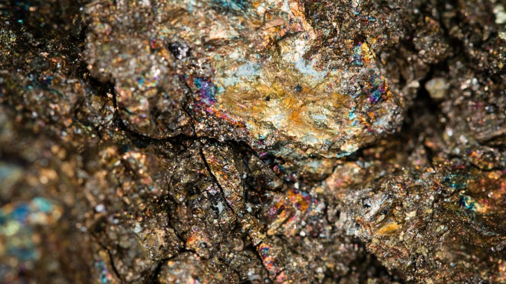
The land that critics had dismissed soon proved remarkably rich. In the early 1840s, Michigan’s state geologist Douglass Houghton reported copper deposits on the Keweenaw Peninsula, and a rush of prospectors followed, according to the National Park Service at Keweenaw National Historical Park and Michigan State University’s copper history page. Both sources date the start of commercial copper mining in the area to 1844.
Iron followed almost immediately. On September 19, 1844, a survey crew led by William Austin Burt noticed their compass needle swinging erratically near present-day Negaunee and found iron ore in the surrounding rock, an event described by Michigan State University’s iron mining history, Northern Michigan University’s archives and the Jackson Mine historical marker. Within a few years the Jackson Mining Company was extracting ore at what is now Negaunee, according to the Jackson Mine historical marker and Northern Michigan University’s archives.
These finds transformed public opinion. History.com notes that attitudes toward the Upper Peninsula shifted once copper and iron were discovered, and Michigan State University’s geography project states that the region proved rich in lumber, copper and iron ore.
Is the Upper Peninsula connected to Michigan?
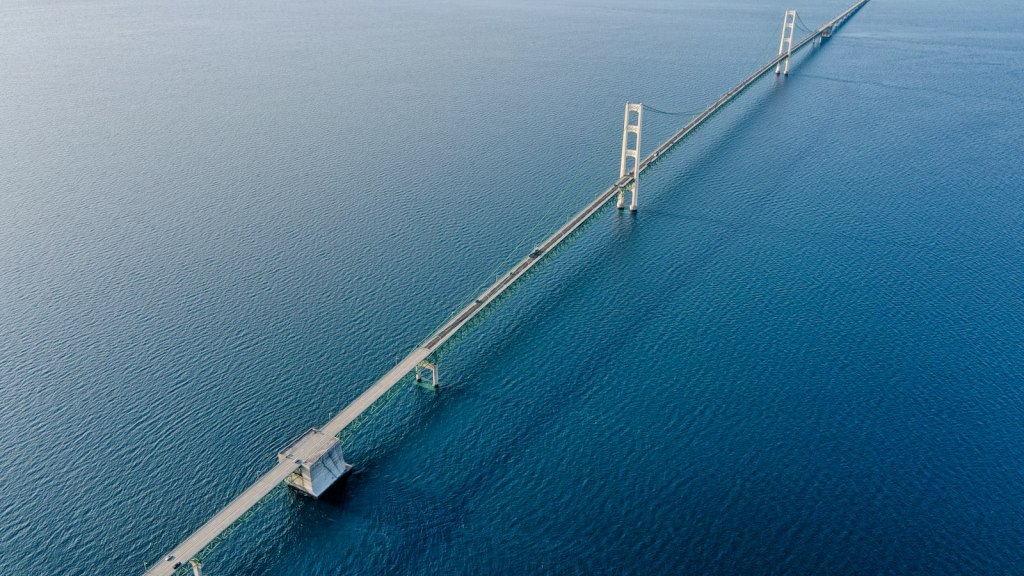
Yes. The Upper Peninsula is part of Michigan, and since 1957 it has been linked to the Lower Peninsula by road across the Straits of Mackinac. Before then, travelers depended on ferries, and the waits could be long, according to Michiganology and ASCE.
The Mackinac Bridge opened to traffic on November 1, 1957, a date given by both Michiganology and ASCE. Construction took more than three years in a harsh climate, both sources note, and the full crossing, including its approaches, is about five miles long, a length also given by Encyclopaedia Britannica. Engineers designed the suspension bridge to withstand the high winds and winter ice of the straits, as Michiganology and Britannica’s entry on the Straits of Mackinac explain.
Today the bridge is the main road link between the two halves of the state. For another chapter of Great Lakes history, see our article on what happened to the Edmund Fitzgerald.
What was left out, and why?
Several details were left out because only one source supported them or because the sources disagreed. One geography source gives Michigan’s admission date as January 27, 1837, while four others give January 26, which is the date used here. Sources give different sizes for the Toledo Strip (about 400 or 468 square miles) and for the Upper Peninsula as a whole, and they disagree on whether Wisconsin Territory was created in April or July 1836. Houghton’s copper report is dated 1840 by one source and 1841 by another, the width of the Straits of Mackinac appears as four miles in one source and about five in another, and the bridge’s length between anchorages differs between sources. One source calls the December 1836 vote unanimous while another says ten of 72 delegates did not sign, and Governor Mason’s age, his removal from office by President Andrew Jackson, the claim that the Upper Peninsula produced more wealth than the California Gold Rush, the year the Jackson Mine opened and the date on which the Upper Peninsula’s “birthday” was declared each appeared in only one source we checked. Claims that the eastern Upper Peninsula already belonged to Michigan before 1836 were also left out for the same reason.
Frequently asked questions
Why does Michigan have the Upper Peninsula and not Wisconsin?
When Congress settled the Toledo dispute in 1836, it needed something to offer Michigan, which was close to statehood. Wisconsin was a newly created territory and did not become a state until 1848. Congress gave Michigan the western Upper Peninsula, and the Supreme Court confirmed Wisconsin’s side of the later border dispute in 1926.
How did Michigan get the Upper Peninsula?
Michigan received it through an 1836 act of Congress that gave the Toledo Strip to Ohio and offered Michigan about 9,000 square miles in the Upper Peninsula. After rejecting the deal in September 1836, Michigan accepted it at the Frostbitten Convention on December 14, 1836, and became a state on January 26, 1837.
Why is the Upper Peninsula part of Michigan?
It is part of Michigan because accepting it, along with the loss of the Toledo Strip, was the condition Congress set for Michigan’s admission to the Union. Michigan met that condition in December 1836.
Is the Upper Peninsula connected to Michigan?
Yes. It is part of Michigan, separated from the Lower Peninsula by the Straits of Mackinac and connected to it by the Mackinac Bridge, which opened on November 1, 1957. The full crossing is about five miles long.
What is the Upper Peninsula of Michigan known for?
The Upper Peninsula is known for its long mining history, especially the copper of the Keweenaw Peninsula and the iron ranges around Negaunee, as well as its forests, its Lake Superior shoreline and the Mackinac Bridge that links it to the rest of the state.
If you enjoy the stories behind maps and borders, subscribe to Mr Global Rankss on YouTube (https://www.youtube.com/@mrglobalrankss) for more history, geography and rankings.
Related reading: Why are there 50 states in the U.S.?, What happened to the Edmund Fitzgerald?
Sources
- History.com: The Toledo War, when Michigan and Ohio nearly came to blows
- Michigan State University, Geography of Michigan: The Toledo War
- Michigan State University Libraries: Michigan's boundaries
- Michigan Legislature, Michigan Manual: Constitutional conventions and statehood
- Michigan House of Representatives: House Resolution 207 (2019), Upper Peninsula birthday
- Historical Marker Database: Michigan Becomes a State (Ann Arbor)
- WXPR: The Michigan-Wisconsin border dispute through history
- Wisconsin Historical Society: Surveying the Wisconsin-Michigan boundary
- Wisconsin Historical Society: Wisconsin Territory
- Wisconsin Lawyer (State Bar of Wisconsin): The Wisconsin-Michigan boundary
- Encyclopaedia Britannica: Upper Peninsula
- Encyclopaedia Britannica: Straits of Mackinac
- Encyclopaedia Britannica: Michigan
- National Park Service, Keweenaw National Historical Park: Copper mining timeline
- Michigan State University: Michigan's copper deposits and mining
- Michigan State University: Early iron mining
- Northern Michigan University Archives: Yankees forge the way
- Michigan Historical Marker (Michigan DNR): Jackson Mine
- Michiganology (Archives of Michigan): The Mighty Mac
- ASCE: Mackinac Bridge historic civil engineering landmark
- Volume One: How Wisconsin lost Michigan's Upper Peninsula


Leave a Reply